
What's inside
The whole operation, one tool.
Built for Canadian farmers and drone spray operators. Offline-first, compliance-ready, acres or hectares.
SPRAY STATUS
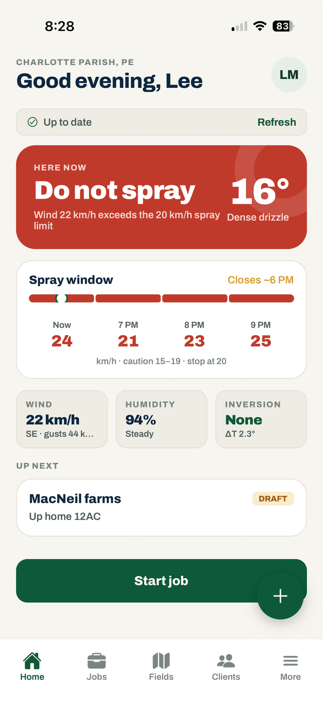
Go / caution / stop — before you unfold the props.
One clear verdict from wind speed and gusts, temperature inversion, and rain probability, with a 12-hour spray-window outlook and a tap-to-learn explainer on every factor.
- Wind, gusts, humidity, and temperature inversion combined into one verdict
- 12-hour spray window — see when conditions open up or close
- Tap any factor for the explanation, no guessing why you're grounded
- Conditions auto-logged at spray time for your compliance record
Schedule & track every spray
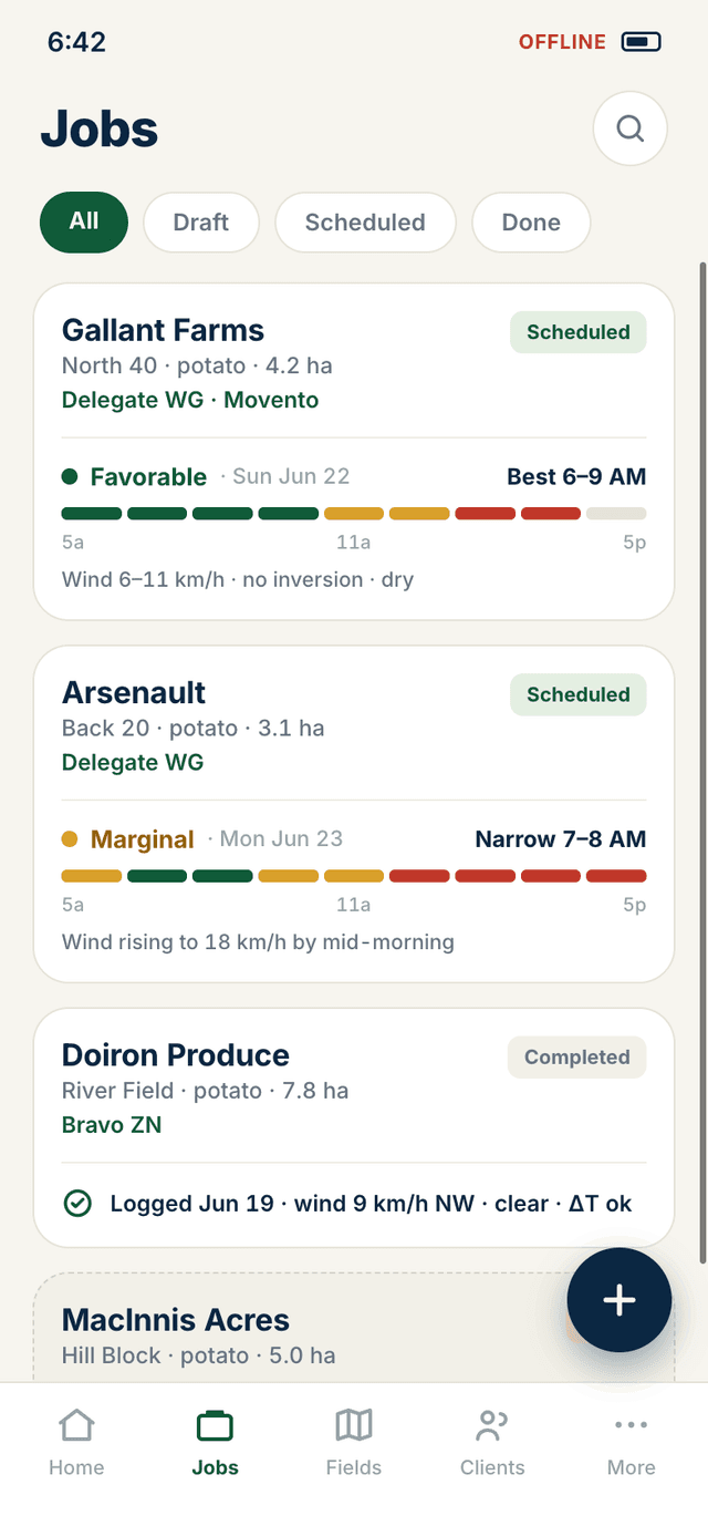
Draft, scheduled, done. Crop, products, date and hectares on every job — your whole queue at a glance, even with no signal.
- Jobs organized by All / Draft / Scheduled / Done
- Per-field spray outlook: Favorable / Marginal conditions
- Full spray history per client and field
- Works completely offline — syncs when you're back in range
Every field, boundary-mapped
Draw your field boundaries on the satellite map — tap to place and adjust points. Tap any field for its full spray history and per-client totals.
- Draw polygon boundaries on the satellite map — adjust any point
- Per-field spray history and running totals
- Distance-sorted list: Closest / By client / Upcoming
- Water body, no-spray, and no-fly zone markersComing soon
COMPLIANCE
Records that keep you legal
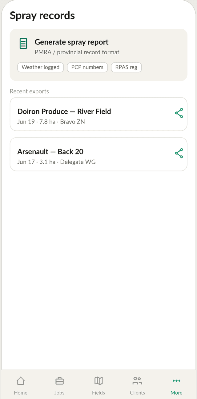
Health Canada requires a record for every pesticide application. Swath writes it — weather auto-logged at spray time, PCP numbers, RPAS registration, in Health Canada / Pesticide Regulatory Directorate (PRD, formerly PMRA) and provincial formats.
- Automatic weather capture at application time
- PCP numbers and RPAS registration included
- PRD-format and provincial record exports
- PDF export ready for audits and inspections
THE DIFFERENTIATOR · LABEL DATA
Drone-approved products only — with the rate right off the label.
From 7,700+ products in the PRD registry, Swath surfaces the subset approved for aerial/drone application in Canada and pulls the actual application rate and carrier volume from each label into the mix calculator.
- Drone-eligible only — filters to the ~1,000 products approved for aerial application, so you're not sifting through products you can't legally drone-spray
- Label-sourced mix rates — application rate + carrier volume pulled from the actual Health Canada label, reducing mixing error and waste
- Find by crop and pest — get to the right approved product fast
- Full traceability — a one-tap link to the official label on every pre-filled value
- Built-in safety guards — no rate shown for a crop the label bars from aerial use; method-unspecified rates are flagged “verify on the label”
- Buffer zones, REI, and PHIComing soon
- You stay in control — the label is authoritative; Swath assists and records, it doesn't decide legality for you
Contains information licensed under the Open Government Licence – Canada. Not affiliated with or endorsed by Health Canada.
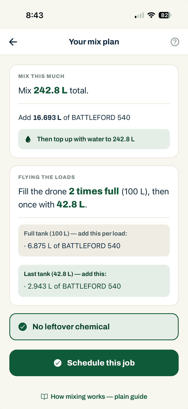
Per-load splits, worked to the millilitre.
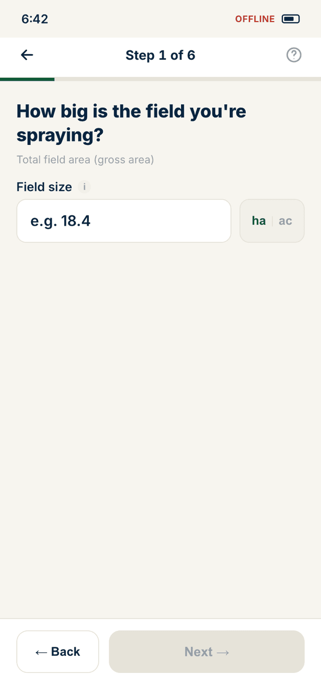
Once the rate is in, Swath calculates the exact total to mix, the per-load split for every full tank, and the partial last load. No mental math, no leftover chemical down the drain.
- Total volume calculated from field size × label rate
- Acres or hectares — rates shown in both, your preference saved
- Per-tank splits for every full load and the partial final load
- Supports multiple products in a single mix
Safety & airspace
Don't get fined. Walk away covered.
Transport Canada and Health Canada problems start in the field, before anyone reviews your records. Swath catches the issues before you fly.
AIRSPACE
Know your airspace before you commit.
Swath warns you the moment a field — or where you're standing — is within Transport Canada's 3 nm airport or 1 nm heliport limit, at field planning, scheduling, your daily fly-status, and a pre-flight check you can't skip. Built on official Government of Canada aerodrome data.
- Airport and heliport proximity checked at field creation, job scheduling, and pre-flight
- Warning shown on your daily fly-status before you leave the yard
- Built on official Government of Canada aerodrome data
- Full controlled-airspace viewComing soon
- Restricted airspace → SFOC promptComing soon
EMERGENCY
The right number, one tap, wherever you are.
A geo-located emergency button on the live-job screen — because emergencies don't wait for you to find the right phone number.
- Pesticide spill: CANUTEC + your provincial spill line, auto-detected by location
- Flyaway / lost-drone: NAV CANADA reporting routed to the correct region
- Poison control and 911
- One tap from the active job screen — no digging through menus
PRE-FLIGHT
A structured pre-flight before every mission.
Conditions, airspace, and equipment — checked and logged before you fly. Walk away knowing you cleared every gate.
- Airspace check built into the pre-flight flow
- Equipment and weather conditions verified and recorded
- Pre-flight signed off and attached to the job record
- Full CARs 901.27 site survey recorded per flight, with searchable archiveComing soon
EQUIPMENT
Your drones, tracked.
Service intervals and a maintenance log for the DJI Agras line, flight hours accrued automatically from every job, plus pilot, RPAS, and pesticide certificates with document upload and expiry dates.
- Flight hours logged automatically from every completed job
- Maintenance log and service intervals for the DJI Agras line
- Pilot, RPAS, and pesticide licence documents + expiry dates
- Certificate-expiry alertsComing soon
Built in
Smarter decisions, fewer mistakes.
Spray Status
Know before you fly
Environment Canada wind, gusts, humidity, and temperature inversion — combined into a single go / caution / stop verdict before every job.
Mix calculator
Label-accurate mixes
Rate pulled from the Health Canada label. Tank splits calculated for every full load and the partial last one — down to the millilitre. Acres or hectares, your choice.
See it in the field.
Join the beta — free to start, offline from day one.